Unlike most of North Africa, the Moroccan countryside has a lot more to offer than just the Sahara Desert.
Morocco’s closeness to Europe has caused a crumpling of the Earth’s crust creating a series of four mountain chains running roughly North-East to South-West across the country and separated by plateaus plains and rugged countryside, forests, rivers, Berber settlements and off the beaten track areas to explore for hikers.
Every hiker from the daring and adventurous to those seeking a walk a little more sedate and gentle can find a trail that will prove suitable and enjoyable for their requirements. So, if you want to get away from the usual tourist trails and couch tours, here are some of the best hiking trails in Morocco.
Some of the shorter routes are easy and safe enough, but for some of the longer, more arduous trails, an experienced local guide is recommended to help with navigation, translation of the languages used (Darija, which is Moroccan Arabic, several Amazigh / Berber dialects, French and even Spanish in some areas.) and knowledge of what to do in emergencies or inclement weather conditions.
Jebel Toubkal
The highest mountain in all of North Africa at 4,167 metres ( 13,670 feet) above sea-level, Jebel Toubkal lies in the High Atlas Mountains which stretch for a thousand kilometres (over six hundred Miles) across the south of the country, Mt. Toubkal provides excellent opportunities for both the more experienced and more moderate hiker.
The most popular ascent is a two-day hike. Firstly, hikers congregate at the Amazigh (Berber) village of Imlil, ninety minutes’ drive from Marrakech, and as you are within the boundaries of the Toubkal National Park, it is a legal requirement, for your safety, to hire an official mountain guide and book a bed for the night at one of the comfortable refuges on the slopes of Mt. Toubkal. Imlil also has many vendors selling good value carpets, rugs, fossils, jewellery and ceramic souvenirs
On the first day, hikers will zigzag up a rugged mountain valley for six hours with plenty of resting points and little shops to top-up your supplies and passing though the Amazigh village of Aroumd. You’ll cross over the river, trek by the shrine to Sidi Chamharouch white walled and the destination of some superstitious Moroccans offer animal sacrifice here to the Sultan of Djinns (King of the Genies), before halting for the evening at the basic Refuge de Toubkal to relax around a campfire and share stories, sing and make new friends, acclimatize and sleep.
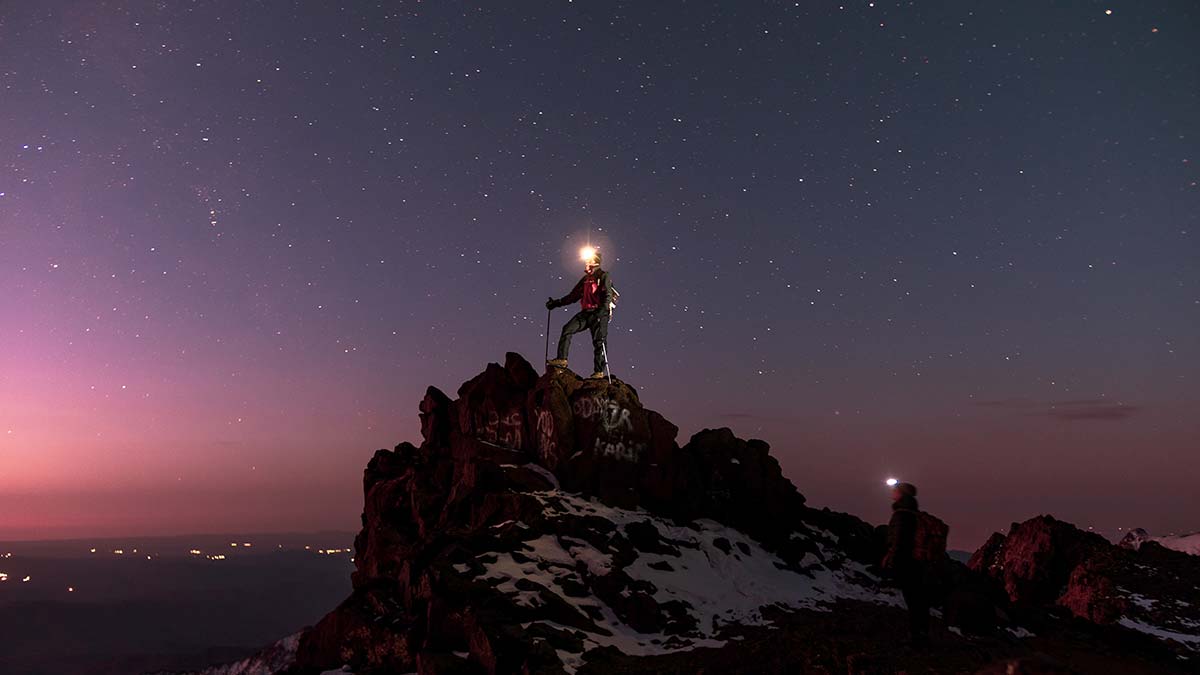
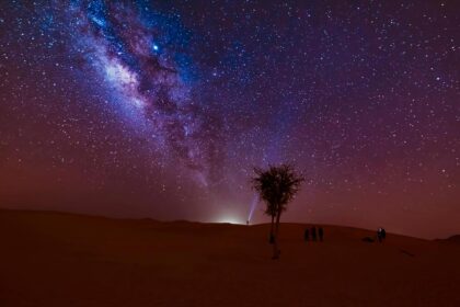
Acclimatizing can be important as altitude sickness is a real danger here. Some choose to sleep outside under the stars in the summer and this is well worthwhile, as the beauty of the multitude of stars visible on a clear night is astounding. The next morning, as the sun rises over the mountains, a most spectacular sight when the weather is fair, the final one kilometre climb, along the ridge of the Tizi n’ Toubkal Pass, to the snow-capped peak is completed.
In the winter months, the whole area is snow-covered and icy and specialist equipment will be required, but for the rest of the year it is usual to have clear, azure skies and a magnificent panoramic view that extends all the way to the Moroccan Sahara in the south.
For the more daring hiker who has the time, the demanding week-long Toubkal Circuit is recommended, which encompasses not only Toubkal, but outlying peaks, Berber villages, green river valleys, dry gullies, rock-strewn expanses and the most incredible views.
Many other treks are offered, such as to the distant lodges in the beautiful Azzaden Valley, or routes that run through the charming Berber villages of Asni and Ikkiss, just ask the mountain guides in Imlil for details.
Places to Stay: Toubkal’s Refuges, the lovely Kasbah du Toubkal, the luxurious Kasbah Tamadot in nearby Asni, the Riad Atlas Chateau, owned by one of the mountain guides, and other kasbahs and lodges in the Azzaden Valley. Homestays can be arranged in Imlil.
The Ifrane Monkey Trail
This is quite a gentle hike, just four and a half miles (seven and a half kilometres) and absolutely ideal for nature lovers.
Ifrane is a charming little place in the Middle Atlas Mountains, a short drive from Fes, built in a Swiss Alpine style by the French during their occupation of Morocco. Surrounding it are the mighty, sweetly-scented, cedar forests of the 500-kilometre square Ifrane National Park where a hiker can encounter a wealth of wildlife including, most famously, the Barbary Apes, actually a species of tailless macaque monkey.
Photo opportunities with these curious animals abound as they will attempt to steal your lunch! But please don’t feed the monkeys as they are becoming unhealthy and acting unnaturally to the extent that they are now under threat due to a bad diet and poaching for sale to zoos, pet shops and street performers. These are the same monkeys that are found in Gibraltar where they are said to have been taken during Andalusian times, when most of Spain was occupied by the Moors from Morocco.
Please don’t feed the monkeys as they are becoming unhealthy and acting unnaturally to the extent that they are now under threat due to a bad diet and poaching for sale to zoos, pet shops and street performers.
There are several other hiking trails here, of easy to moderate rating, and there are mountain biking trails, too. Other animals to watch out for here include many species of beautiful birds, butterflies. wild boar and foxes, ferns and huge, ancient oak trees as well as the aromatic cedars.
Places to Stay: There are plenty of choices for accommodation at prices to suit all pockets in Ifrane and nearby Azrou.
Moulay Idriss to Volubilis
Only a forty-minute drive from the Imperial City of Meknes, or about double that from another Imperial City; Fes lies the pilgrimage town of Moulay Idriss Zerhoun where lies the tomb of Sultan Idriss I who was a descendant of the Prophet Mohammed, the first Muslim ruler of Morocco and the founder of Fes.
This village is the starting point of a hiking trail in Morocco for history aficionados starting at whitewashed Moulay Idriss and ending in Volubilis.
Starting from the bus station in Moulay Idriss you walk down to the roundabout and follow the signposts that lead you along a straightforward, downhill trek that winds through fragrant pine forests, past olive groves and across a fertile, green plain to the ancient Amazigh/Roman ruins of Volubilis, famous for its well-preserved mosaics, standing and fallen columns and triumphal arch, once a home for wealthy Romans and an exotic holiday destination on the outer fringes of the Roman Empire. It is now one of the most popular tourist destinations in Morocco and a UNESCO world heritage site.
Akchour Waterfall, God’s Bridge and Chefchaouen
The ‘Blue City’ of Chefchaouen with its unique, blue-painted walls is well worth a visit to experience walking through the narrow, cobbled streets with a feeling of walking at the bottom of a shallow, tropical ocean. Chefchaouen is situated in the Rif Mountains in the north of Morocco and is in the centre of the Talassemtane National Park which offers many opportunities for all levels of hikers to experience the ancient fir forests and waterfalls as blue as Chefchaouen!
One of the most popular hiking trails in the region is the Akchour Trail which begins in the village of the same name, a short drive from Chefchaouen. Walk towards the hydroelectric dam and turn left at the first fork in the road onto a pathway that winds gently down through the evergreen firs and moss-encrusted boulders to a little waterfall, but keep going and you will come to the imposing and beautiful Akchour Waterfall where you can go for a dip in its forest green plunge pool.
When you are content and refreshed, return to the fork in the path before the dam and take the right turning this time, which will lead you sharply uphill to God’s Bridge, a geological phenomenon where running water has created a natural arch over a shear-walled crevasse. If you decide to do both trails, it will take about five hours of hiking in total as the walk covers about 14km ( 8 and a half miles).
A nice little half-day stroll can be taken from Chefchaouen along the winding banks of the Ras el-Maa River or there is the option of a day’s hiking up the
Jebel al-Kalaa that overlooks the city.
Places to Stay: Try out one of the wood and rock-built eco-friendly cabins of the Ermitage d’Akchour or the Dar Antonio guesthouse in Chefchaouen.
Ouzoud Waterfall
This is one of the easier, all-year-round treks on the list, a visit to a stunningly beautiful waterfall not far from Marrakech. It’s only a half-day trek, so you can get a grand taxi from Marrakech in the morning for the two-and-a-half-hour drive to the Cascade Ouzoud. Alternatively, the travel agents in Marrakech can arrange a day trip for you. The waterfall is stunning as it plunges 110 metres down a rough, red rock face.
It’s nice to begin the trek higher up, 600 metres above the plunge pool and enjoy a relaxing walk downhill, trying to avoid the Barbary Apes trying to steal your handbags or food. The walk only takes an hour or so, and just sitting and enjoying the splendour of the waterfall in the cooling mist it creates is reward enough.
Places to Stay: Anywhere in Marrakech or there are guest houses in the nearby village of Tanaghmeilt.
The Jebel Saghro Circuit
The Jebel Saghro Circuit is a lengthy hike which takes five days in its entirety, covering ninety kilometres (56 miles) over some breathtaking terrain. It’s not as difficult a trek as some of the other mountain routes, as it weaves gently for the most part, with only a few sharp inclines and sudden descents.
The Saghro Massive is a rocky oddity that outcrops between the lofty High Atlas and the Sahara Desert in the south-east of Morocco and is an area of outstanding natural beauty, a land of weird rock formations, deep gorges, flat-topped mesas, and rocky plains like the surface of the moon. There are also caves with interesting cave paintings that can be visited. On the hard-ground trackways you will encounter people from the semi-nomadic Ait Atta Berber tribe who live in this remote region. Some of these gentle people are guides to the Circuit and using a guide is recommended if you’re not so good at map-reading or navigation. And don’t forget to ensure you are well supplied with provisions and water.
The highest point is Amalou N’Mansour at 2,712m (8,898 feet) above sea level.
The circuit begins at Tagdilt, near the Boumalne Dades, and concludes at Kalaat M’Gouna, passing through the quaint Berber villages of N’kob and Tazzarine.
There is an option to this circuit where you can extend the hike by a further day to take in Jebel Kouaouch whose 2,595m (8,595 feet) peak offers the most incredible views for miles in every direction. There are also innumerable shorter walks and hikes in the Jebel Saghro region, both smaller circuits or one-way trails.
Places to Stay: The Kasbah Hotel Ait Omar to the south of the region in the oasis town of N’kob is recommended; the restaurant has excellent vegetarian fare, the hotel is very friendly and can advise on routes and suggest a guide and the town is ideal for stocking up on provisions and also for acquiring an experienced guide. The Hotel Tomboctou in Tinghir, a small, cosy kasbah with a pool and bar.
Ait Bougmez and The Mgoun Massif
With trails starting at Tabant in the Central High Atlas Mountains, the hiking trails around the area of Ait Bougmez and Mgoun are rarely visited and are away from the usual trails in every sense. It’s a six-hour drive from Marrakech. The routes are of moderate difficulty and may vary between one and four days in duration.
Ait Bougmez is a beautiful valley that cuts through the region known as the Mgoun Massif, with panoramic views over verdant pasturelands and many tiny Berber villages inhabited by friendly hospitable local people.
Mount Mgoun is the second highest mountain in North Africa, only a hundred metres less in height than the more famous Mount Toubkal, but is far less visited. Every spring the people of the southern Ait Atta tribe migrate north across the mountain to the shores of Lake Izourar, formed by glaciers, to spend the summer months before heading back south as winter closes in. Hikers with enough experience are welcome to join the nomads and flocks of sheep, their pack donkeys, mules and horses as they carry all the supplies that they will need for the summer, trekking across the mountains, through juniper forests to the shores of the lake.
The valley of Ait Bougmez and the adjacent Tessaout Valley are particularly stunning in the spring, when it is carpeted with wildflowers of many colours and there is a vivid contrast of colours with the fresh green grass contrasting with the gradually melting patches of snow.
These hiking trails are not for the winter months when temperatures are below freezing and even the nomads will have moved to warmer climes in the south.
Places to Stay: The Touda Eco-Lodge, various trekking lodges and hotels in Tabant; the Kasbah Assafar in Ait Khyar and the nearby Assafar Cottage.
Tafrouate
Situated in the south of Morocco in the Anti-Atlas Mountains, Tafrouate has several easy-to-moderate local hiking trails up through the AmeIn Valley to the famous blue rocks and prehistoric stone carvings of animals. You pass by many tiny Berber communities in the valley, wander through almond groves and argan trees, which are unique to south-west Morocco and produce a nut which produces an oil used in cooking said to be better and healthier than olive oil. Tafrouate is especially worth a visit during the annual almond festival, usually taking place in February, but the times may vary due to the harvest, so it is wise to check beforehand. The pageantry, singing, music and dancing celebrate local traditions and folklore. Tafrouate is also well-known for its multi-coloured slippers (babouche), unique to this region.
A longer trek, that can take two or three days, is also available from Tafrouate that also takes in the sights of Jebel Kest, the highest mountain in this region.
From autumn until spring, Tafrouate is also frequented by rock-climbers who enjoy the challenge of red rock faces and the huge boulders that litter the area.
Places to Stay: Guest houses in Tafrouate.
The Todra Gorge
The Todra, or Toghda Gorge is renowned for its rock-climbing opportunities up the 300 metre shear walled canyon sides, while the houses, cafes, guest houses and shops run along the banks of the river below, pressed tightly against the sides of the gorge. Here there are shops selling local handicrafts to the many tourists that stop here every day. But the village also provides an ideal base for those wanting to avail themselves of the various hiking trails that the area provides which pass-through groves of date palms to the mountain peaks beyond. Nomadic Berber families pitch their tents here or live in mudbrick dwellings. Views from the top of the gorge are spectacular, but beware the sun; there is no shelter as few trees grow here, only a few bushes and shrubs, so also ensure you take plenty of water with you on your trek.
Nearby is the Dades valley and the Dades Gorge, the latter of which exhibits the famous rock formations known as “monkey fingers”. This area is worth at least a half-day of trekking through the rocks, green valleys and crossing the many sparkling rivers and streams on tiny foot bridges
Places to Stay : Many three-star guest houses are situated within the Todra Gorge. Hostels in the Dades Valley. A wider choice of accommodation is available in the nearby city of Boulemane.
Jebel Sirwa
The link between the High Atlas and the Anti Atlas mountain ranges is the extinct volcano of Jebel Sirwa, rising to 3,304 metres (10, 840 feet) above sea level. Starting from the nearby town of Atougha, it usually takes two days to complete the climb and en route, you’ll pass by several Berber villages surrounded by steeply terraced fields of crops. The final ascent is actually quite hazardous, so a guide is highly recommended.
Paradise Valley
Agadir is a southern city on the Atlantic coast, best known for its stunning beaches and water sports activities.
But a little inland lies paradise valley, a verdant green, steep-sided river valley offering excellent hiking along the river northwards for 60 km (37 miles) all the way to Imouzzer Ida Ou Tanane.
Or there is a pleasant and much shorter hike, only 3km (less than 2 miles) from Imouzzer Ida Ou Tanane to a series of waterfalls known only as “The Cascades”.
Read also: Hiking around Chefchaouen: Top 5 breathtaking hiking trails


